
Nowa Sól III

-
Local Spatial Development Plan:
Industry / Services / Warehouses - Maximum Building Height: 40m
-
Biologically Active Area: Min. 5%
- Maximum Building Coverage: 80%
* Environmental Decision Obtained
 Offer Details:
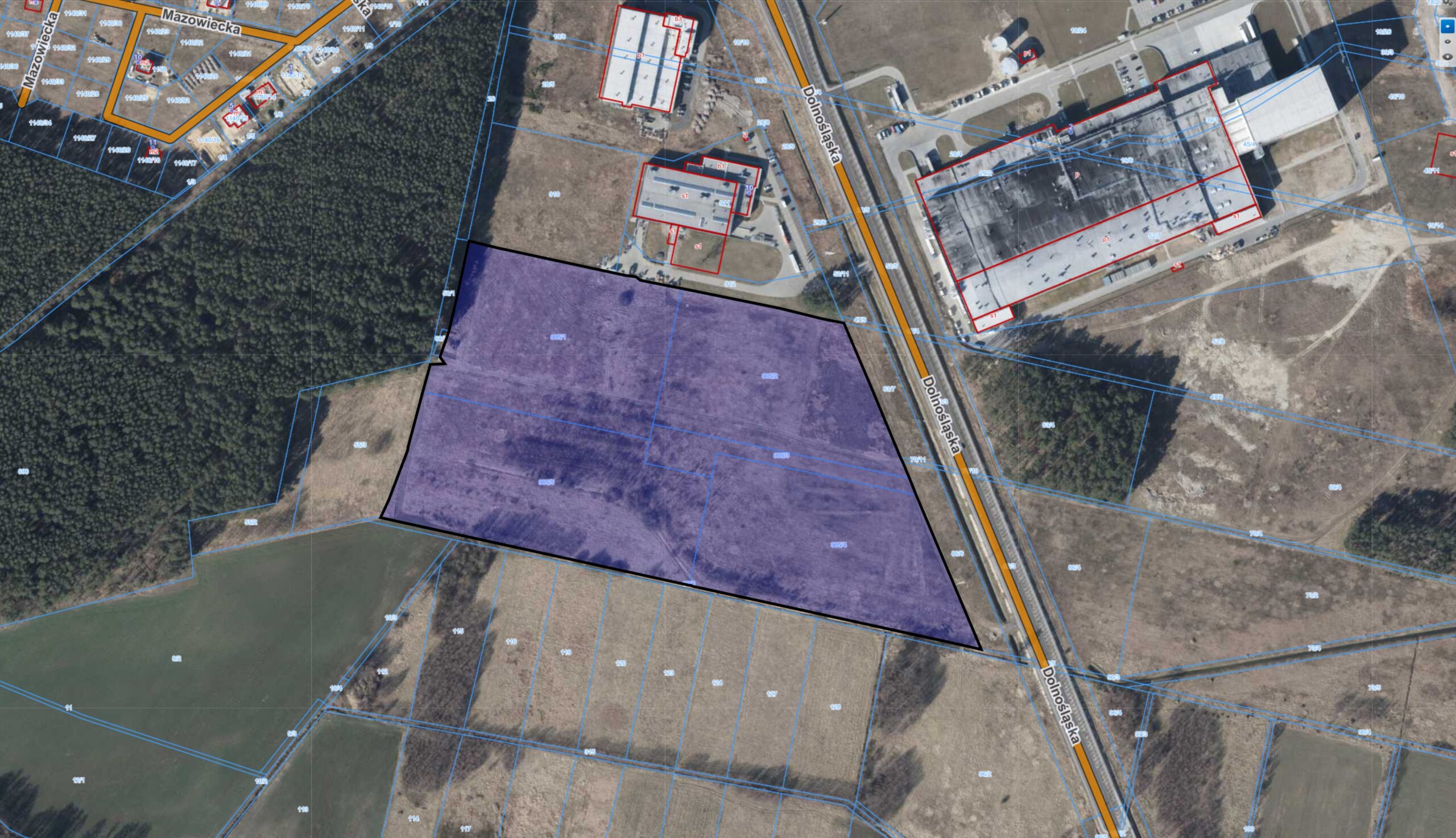
Info
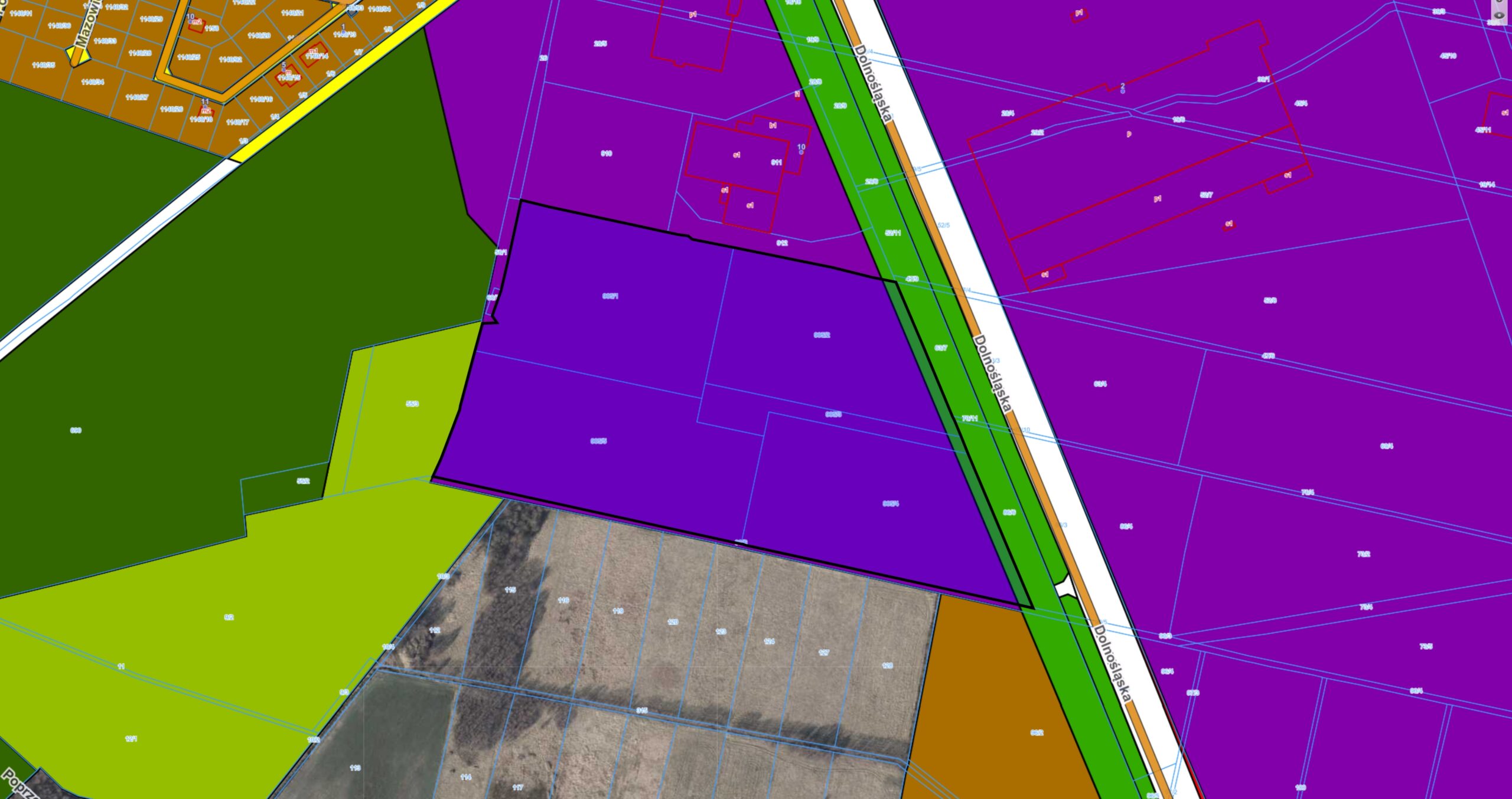
The plot of over 8.41 hectares is located in Nowa Sól (Lubuskie Voivodeship), within the Southern Economic Zone, directly by the S3 route. The proposed location has a local spatial development plan, allowing for quick development. A production / warehouse / logistics / service facility with a maximum area of 42,000 m² can be built here.
Building Information:
*Available soon
Location
City / Commune: Nowa Sól
Address / Street: Dolnośląska
County: Nowa Sól
Voivodeship: Lubuskie
SEZ: Kostrzyńsko-Słubicka SSE
- (LINK) GEOPORTAL
- (LINK) MUNICIPAL GEPORTAL
- (LINK) GOOGLE MAPS
Area
Land Area: 8.41 ha
Plot Shape: Other / Regular
Zoning Plan
- Designation in MPZP: Production buildings, warehouses
- Building Form: Production or service buildings in detached or dense development
- Maximum Building Intensity Index: 4.0
- Building Coverage: Up to 80% of the plot area
- Biologically Active Area: At least 5% of the plot area
- Building Height: Up to 40m to the ridge or highest edge
- (LINK) Zoning Plan
Transport Connections:
Highway / Expressway:
– S3 expressroad: 4,6 km / 5 min
– A18/A4 motorway: 52 km / 53 min
– A2 motorway: 71,6 km / 44 min
Port: Nowa Sól River Port (Oder): 4.6 km
Railway / Siding: Nowa Sól / 3.5 km
Airport:
– Zielona Góra – Babimost Airport: 56.8 km
– Wrocław Airport: 160 km
Cities:
– Zielona Góra – 22 km / 16 min
– Poznań – 163 km / 1 h 32 min
– Wrocław – 123 km / 1 h 30 min
– Berlin – 222 km / 2 h 19 min
Utilities
Connection Conditions Received for 4.9 MW
✓ Gas: 3200 m3/h
✓ Water
✓ Sewage
*Environmental Decision Obtained